Our nursery is located on very young ground, less than 80 years ago the whole area was still in the sea. How is that possible? Allow us to take you briefly through the history of the Noordoostpolder (North-East Polder).
The Noordoostpolder is part of the Zuiderzee Act, which was devised by the engineer Cornelis Lely. Following the food shortage during the First World War and the disastrous floods in 1916, the Netherlands was looking for space where food production would be the primary activity as a solution to this problem. In other words, an agricultural region.
In 1942, the Noordoostpolder was officially reclaimed from the former Zuiderzee. 48,000 hectares, 1577 farms on plots ranging in size from 12 to 48 hectares. Straight roads, parcels of land and structured water management. 10 villages with carefully selected residents. Five different types of farm, one task; to turn a new piece of land into an efficient agricultural Valhalla.
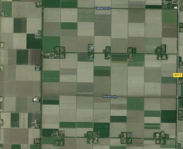
Anyone looking at the map of the North-East Polder can see that all the roads, ditches and parcels of land are very structured. Plots are divided into blocks of mainly 48, 24 and 12 hectares. A plot measuring 300 by 800 metres was considered optimal during a survey in 1936. This was mainly due to the drainage technology used at the time, which allowed a maximum plot width of 300 metres. The Dutch government finally agreed to allot 1,577 farms of 12 to 48 hectares.
At this time, the farms were placed together in clusters of two, three or four. Farmers were expected to form groups to help each other with work in the fields, fires or accidents. There were also financial benefits to this. Only one fire hydrant was needed, for example, and one transformer.
The Kraggenburg, Marknesse and Luttelgeest area – where our nursery is based – has a clay and sandy soil and was therefore classified as a fruit-growing area. This can still be seen today in the smaller plots (12 hectares) and the typical farmhouses.
The village plan dates back to 1946. The location of the villages is aligned with a grid of roads, canals and plots. Research was conducted to find out which distances suited the farm workers. A plan was then made to place all the villages 7 to 9 kilometres from the 'capital’ Emmeloord in a neatly divided circle.
Today, many of the original farmhouses have been converted into residential farms and small agricultural businesses are being taken over by larger parties. Land is also still being leased, rented or exchanged. The polder farmers know the meaning of collaboration.
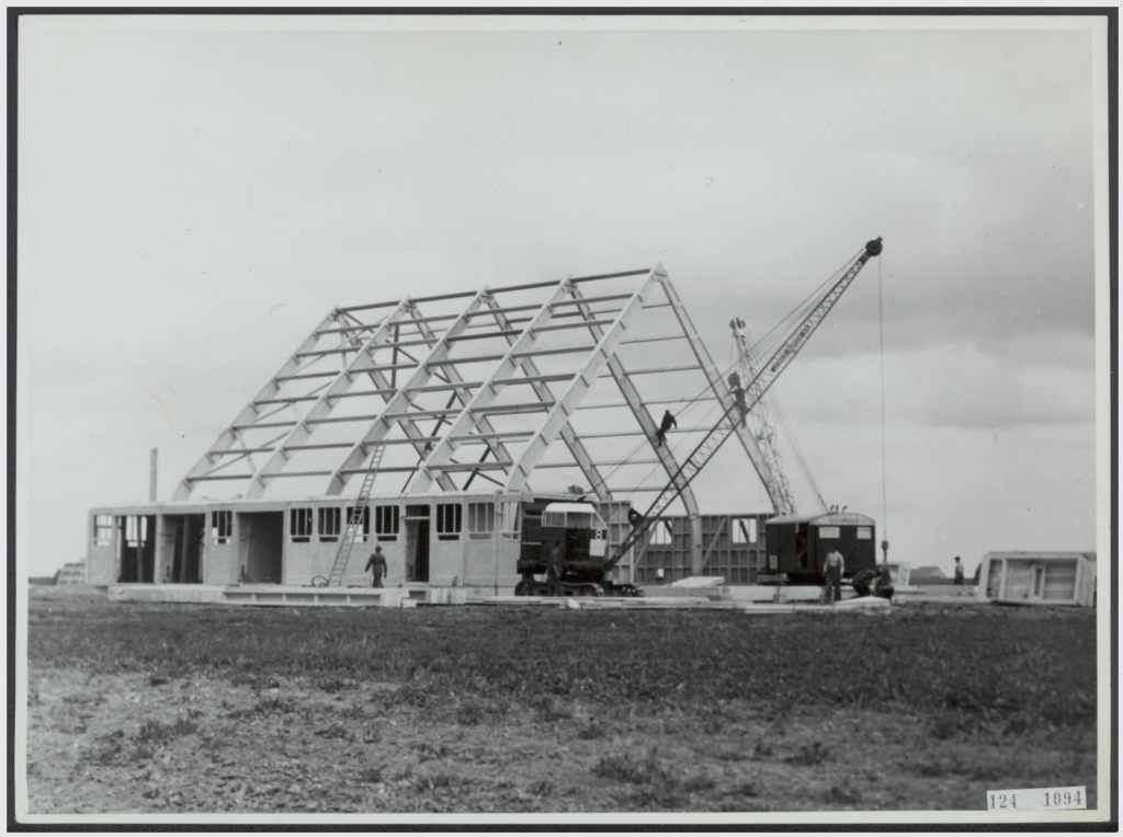
Our nursery’s farmhouse plot is located on plot number M121, a 24-hectare plot of light clay, and is more than 3.5 metres below sea level. The buildings on this plot are the ’Classic Noordoostpolder Farm’ Type A – a detached tenant farm with a pre-cast concrete barn, typical of those usually found on arable farms.